
Natural Hazard Disclosure Reports Now Include New Flood Disclosures
Central Valley Natural Hazard Disclosure Local-Level Flood Disclosures
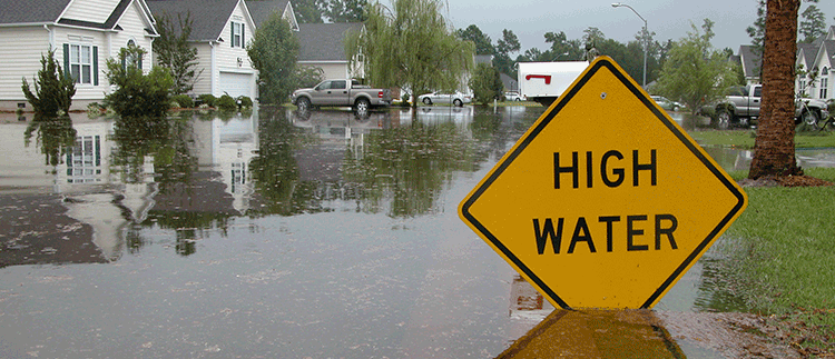
In 2007, several State laws were passed to address flooding risks in California. AB 5 (Wolk), SB 5 (Machado), SB 17 (Florez), and AB 162 (Wolk) require that urban and urbanizing areas in the Sacramento Valley and San Joaquin Valley achieve or make adequate progress toward achieving 200-year protection by the year 2015. This requirement was set in order to continue approving development in the floodplain. AB 162 specifically, requires that each local jurisdiction’s Safety Element include 200-year floodplain maps.
New local zones for disclosure included in most Central Valley Counties and City General Plans:
Department of Water Resources (DWR) Levee Flood Protection Zone:
The Levee Flood Protection Zone (LFPZ) maps were developed by DWR as required by Water Code Section 9130 to increase awareness of flood risks associated with State-Federal levees. The maps should not be confused with FEMA’s FIRMs used for the National Flood Insurance Program. The maps developed by the DWR are not reflecting the same type of flood hazard as FEMA’s and they were prepared for different purposes. LFPZ maps focus on flood risks associated with State-Federal levees and estimate the maximum area that may be flooded, if a State-Federal levee fails, with flows at maximum capacity that may reasonably be conveyed.
Department of Water Resources (DWR) 200-Year Floodplain:
Pursuant to SB 5 (Machado, 2007) and AB 162 (Wolk, 2007), the California Department of Water Resources (DWR) and Central Valley Flood Protection Board are required to prepare and adopt a Central Valley Flood Protection Plan (CVFPP). The intent of the project is to identify all of the pertinent flood hazard areas and determine if there are sections which are not mapped under the Federal Emergency Management Agency’s (FEMA) National Flood Insurance Program (NFIP). Additionally they will provide the community and residents an additional tool in understanding potential flood hazards currently not mapped as a regulated floodplain. 200-year flood zones are developed independently from NFIP Flood Insurance Rate Maps and many FEMA 100-year flood zones are not included on the DWR maps.
Department of Water Resources (DWR) Floodplain Awareness Zone:
The intent of the DWR’s Awareness Floodplain Mapping project is to identify all pertinent flood hazard areas by 2015 for areas that are not mapped under FEMA’s National Flood Insurance Program (NFIP) and to provide the community and residents an additional tool in understanding potential flood hazards currently not mapped as a regulated floodplain. The awareness maps identify the 100-year flood hazard areas using approximate assessment procedures.
Order Your Natural Hazard Disclosure Report to Give Your Clients a Higher Level of Protection
HomeGuard provides termite, home and roof inspections as well as NHD reports for the Bay Area, Central Valley, Sacramento area and much of Northern California. We discount the Complete Package (NHD/Environmental/Tax Reports) to only $109 (regularly $129) when you use HomeGuard for any inspection or Home Warranty. NHD Complete Package will be discounted further, to only $89 when you order all five services! Contact us at NHDorders@homeguard.com, visit our website, or call 855-331-1900 for more details on the services we offer.