HomeGuard’s Natural Hazard Disclosure Reports are prepared by qualified individuals, we use up-to-date information, and we rely on mapped information and not solely on digital hazard data. Aside from providing accurate and easy to read and understand natural hazard disclosure reports (see sample), HomeGuard has partnered with Environmental Risk Information Services (ERIS) to provide an environmental hazard disclosure report. Based on the experience and expertise of the leading national provider of environmental risk information, The ERIS Environmental Hazard Report offers accurate, comprehensive and easy to understand coverage of the most common and high-risk environmental hazards.
Also, by offering the California Tax Data Report to satisfy mandatory tax disclosures in California, HomeGuard is providing the most comprehensive information of California property tax data. The information is updated continuously to ensure accurate and up-to-date reporting.
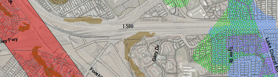
What is in the HomeGuard NHD Report?
Many reports in the industry claim to provide complete disclosure of statutory and local disclosures. By ordering the HomeGuard NHD Report, you are getting a complete Natural Hazard Disclosure report, not only including required disclosures but also County-level and City-level seismic safety element disclosures as well as other local pertinent disclosures related to the industry.
Few Counties and Cities have ordinances that require hazards to be disclosed, but since these hazards are on maps that are publicly available, they could be considered a “material fact” for disclosure. Material facts can be anything that affects the buyer’s decision to purchase the property. When providing a Natural Hazard Disclosure report, it should be considered mandatory to use a company that discloses these hazards.
Active and Potentially Active Faults:
State-level Alquist-Priolo Earthquake Fault Maps only include faults that are considered active. Many local jurisdictions not only include active, but also potentially active and inactive faults on their maps. As a standard, local planning departments adopt the same building restrictions for potentially active faults as they do active faults.
Liquefaction and Landslide Zones:
While all jurisdictions are required to use State Seismic Hazard Zone maps for planning purposes, only portions of the State have been mapped to date. Even in areas where mapping has been provided by the state, local jurisdictions may have additional hazard areas, the hazards mapped in greater detail, or in different manner such as “high, moderate, low, etc”.
Other Hazard Zones:
Statutory maps do not include other hazard that may be applicable to certain Counties such as tsunami inundation areas for coastal areas, avalanche hazards in mountainous areas, blow sand hazards in the desert, or subsidence, expansive soils, and other hazards that may be common in your community.
FEMA Special Flood Hazard Areas:
also known as “100 year floodplains”, are portions of a river or stream channel and adjacent lands that are subject to floods with at least a one-percent chance of being exceeded in any given year.
Areas of Potential Flooding (Dam Failure Inundation Area)
represent areas that could be inundated by a sudden and total failure of a dam or retaining structure. These maps are based on a worst-case scenario event in that the reservoir is filled to capacity and the dam fails instantaneously. However, dams rarely fail instantaneously and reservoirs are not always filled to capacity. Areas could still be flooded in the event of a partial failure or dam breech.
Very High Fire Hazard Severity Zones
originated as a response to the 1991 Oakland Hills firestorm. These maps depict a high fire risk due to topography, dwelling density, brush coverage, climate, etc. Properties located in a Very High Fire Hazard Severity Zone (VHFHSZ) are subject to certain fire prevention property maintenance requirements.
State Responsibility Areas
represent those areas of the state for which the State has the financial responsibility of preventing and suppressing fires. Under PRC Sections 4125 and 4126, these areas roughly correspond to vegetated lands that have watershed value. Lands in incorporated cities or owned by the federal government are excluded. SRA lands cover about 31 million acres in 56 counties.
Earthquake Fault Zones
represent mapped zones adjacent to active faults. The Alquist-Priolo Earthquake Fault Zoning Act’s main purpose is to prevent the construction of buildings used for human occupancy on the surface trace of active faults. The Act only addresses the hazard of surface fault rupture and is not directed toward other earthquake hazards. The Alquist-Priolo Earthquake Fault Zone Act was passed in 1972 to mitigate the hazard of surface faulting to structures. This state law was a direct result of the 1971 San Fernando Earthquake, which was associated with extensive surface fault ruptures that damaged numerous homes, commercial buildings, and other structures.
If a property is within an Earthquake Fault Zone, it means that an active fault is present within the zone and the fault may pose a risk of surface rupture to existing or future structures.
Seismic Hazard Zones
are regulatory zones that encompass areas prone to liquefaction (failure of water-saturated soil) and earthquake-induced landslides. What does it mean to be located within a Seismic Hazard Zone? It means that the state has determined that it is likely that weak soil and/or rock may be present beneath the property. If present, these weak materials can fail during an earthquake and, unless proper precautions are taken during grading and construction, can cause damage to structures. If a property is undeveloped, a site-specific investigation by a licensed engineering geologist and/or civil engineer may be required before the parcel can be subdivided or before most structures can be permitted.
Liquefaction occurs when a saturated formation, typically sandy soil, is turned into a liquid. The key ingredient is a formation of loose, saturated sand. A key component of mapping liquefaction hazard is estimating the shaking needed to trigger liquefaction. The answer is largely based on just how susceptible the material is to liquefaction. In areas exposed to moderate shaking, a material that is highly susceptible to liquefaction may liquefy, but an adjacent material that is moderately susceptible may not.
Airport Influence Areas (AIA)
are determined by County Airport Land Use Commissions (ALUC). Typically, the size of an AIA is dependant on length of runway, and whether or not larger jet aircraft take off and land at the facility. In situations where a County ALUC has not determined airport influence areas, California Civil Code 1102.6a requires that a 2-mile airport proximity disclosure be used to satisfy the disclosure.
Even though a property may not be within a defined airport influence area, the property may still be subject to airplanes and other aircraft, commercial or military or both, flying overhead. Noise levels and types of noise that bother one person may be acceptable others.
Formerly Used Defense Sites (FUDS)
Were established by Congress in the mid-1990’s. The FUDS program cleans up properties formerly owned, leased, possessed, or used by the military services. Properties included in the program range from privately owned property to National Parks, and can be located in industrial areas, residential developments, and public areas. The type of cleanup required varies from property to property but would likely include conducting building demolition and debris removal, cleanup of environmental contamination, radioactive waste, other common industrial waste, ordnance and/or other warfare material including chemical weaponry.
San Francisco Bay Conservation and Development Commission (BCDC)
is the federally-designated state coastal management agency for San Francisco Bay and has jurisdiction in the greater San Francisco Bay Area to administer the State’s McAteer-Petris Act (the key legal provision under California state law to preserve San Francisco Bay from indiscriminate filling), the San Francisco Bay Plan, and the Suisun Marsh Preservation Act. The BCDC’s primary roles in wetlands management in the Bay are planning the protection, enhancement, and restoration of wetlands, and balancing the protection of wetlands against other often high priority objectives. All projects proposed in tidal wetlands within the BCDC’s jurisdiction require an approved BCDC permit before proceeding.
Effective July 1, 2005, sellers must disclose to buyers of their property is located within the jurisdiction of the BCDC.
Radon
comes from the natural breakdown of uranium in soil, rock and water and gets into the air one breathes. Radon is odorless, tasteless, and colorless, but could be a potential problem in any home. Radon is the second leading cause of lung cancer following smoking. Radon can be found throughout the United States and can get into any type of building (homes, offices, and schools) and result in a high indoor radon level.
The United States EPA and the United States Geological Survey (USGS) have evaluated the radon potential in the United States and have developed a County-specific map to assist local organizations to target their resources and to assist building code officials in deciding whether radon-resistant features are applicable in new construction.
Naturally Occurring Asbestos
Naturally Occurring Asbestos deposits can be found throughout much of California. The exposure to asbestos may create a significant health risk, and the presence of asbestos-bearing minerals may result in restrictions on the use or development of the property. Asbestos is classified as a known human carcinogen by state, federal, and international agencies and was identified by the Air Resources Board (ARB) as a toxic air contaminant in 1986. Naturally occurring asbestos minerals belong to either the serpentine mineral group or the amphibole mineral group. The most common type of asbestos found in California is chrysotile, a serpentine mineral. The risk of disease depends upon the intensity and duration of exposure. Exposure to low levels of asbestos for short periods of time poses minimal risk. Asbestos fibers can penetrate body tissues and remain in the lungs and the tissue lining of the lungs and abdominal cavity. The fibers that remain in the body are thought to be responsible for asbestos-related disease. The illnesses caused by asbestos may not be observed for twenty or more years. The most common serious diseases caused by asbestos are asbestosis (a non-cancerous lung disease), lung cancer, and mesothelioma (cancer of the thin membranes lining the lungs, chest, and abdominal cavity).
Right to Farm Disclosure took effect January 1, 2009.
Sellers must disclose to buyers if their property is located within one mile of farmland or ranch land as mandated by Civil Code Section 1103.4. Right to Farm ordinances exists in most counties in California. These ordinances permit operation of properly conducted agricultural operations. If the property being purchased is located near agricultural lands or operations or included within an area zoned for agricultural purposes, homeowners may be subject to inconveniences or discomfort arising from such operations. Such discomfort or inconveniences may include, but are not limited to: noise, odors, fumes, dust, smoke, insects, rodents and/or the operation of machinery (including aircraft) during any 24-hour period, storage and disposal of manure, and the application by spraying or otherwise chemical fertilizers, soil amendments, herbicides and pesticides. When buying property near an agricultural area, buyers should be prepared to accept such inconveniences or discomfort as a normal and necessary aspect of living in a county with a strong rural character and an active agricultural sector.
Tsunami Inundation Disclosure
affects most coastal communities in California. A tsunami is a wave, or series of waves, generated by an earthquake, landslide, volcanic eruption, or even large meteor hitting the ocean (The Japanese word tsu means “harbor” nami means “wave”). What typically happens is a large, submarine earthquake (magnitude 8 or higher) creates a significant up ward movement of the sea floor resulting in a rise or mounding of water at the ocean surface. This mound of water moves away from this center in all directions as a tsunami. A tsunami can travel across the open ocean at about 500-miles per hour, the speed of a jet airliner. As the wave approaches land and as the ocean shallows, the wave slows down to about 30 miles-per-hour and grows significantly in height (amplitude).
Gas Transmission Pipeline & Hazardous Liquid Pipeline Disclosure
was added to the HomeGuard NHD Report on January 1, 2011. The Pipeline Safety and Community Empowerment Act of 2010 (H.R. 6295) was introduced in September 2010 to enhance pipeline safety, and provide communities with access to improved information concerning the equipment and operations of pipeline facilities. The proposed legislation aims to provide notice to homeowners of the proximity of the property to the transmission line, access to mapped information, install automatic or remote shut off valves, implement improved inspection standards, as well as other risk management practices. Mapped information and data through the National Pipeline Mapping System (NPMS) consists of gas transmission pipelines, hazardous liquid trunklines, liquefied natural gas (LNG) plants, and breakout tanks (tanks used to relieve surges in hazardous liquid pipelines). The NPMS does not contain information on interconnects, pump and compressor stations, valves, direction of flow, capacity, throughput, operating pressure, or gathering or distribution pipelines, such as lines which deliver gas to a customer’s home. Therefore, not all pipelines in an area will be visible in the Public Map Viewer. To view maps, please visit: http://www.npms.phmsa.dot.gov
California High-Speed Rail Advisory
was added to the HomeGuard NHD Report in August 2010. The approval by California voters of Proposition 1A in 2008 authorized the funding of a high-speed rail system in California and the creation of the California High-Speed Rail Authority, the entity responsible for planning, constructing and operating this Rail System, intended to link various cities up and down the state. The exact route that the proposed Rail System would take and how its construction and operation might affect surrounding communities have been the subject of considerable concern and debate. Along with its benefits, possible negative impacts of the Rail System could include, without limitation, noise, dust, traffic interruption, street closures and/or configurations, visual impacts, possible diminution of property values and other consequences on a particular neighborhood. Precisely what impact, if any, the Rail System would have on any particular piece of real property either before, during or after construction and placement in operation is unknown; certainly it will affect people and properties differently. Real estate agents are not experts regarding the Rail System, and prospective buyers are advised to investigate and satisfy themselves in regard thereto during property inspection contingency periods. Important information about the Rail System may be obtained by contacting the Authority directly or by visiting the website http://www.cahighspeedrail.ca.gov.
Endangered Species exist throughout the state.
The California Endangered Species Act (CESA) (Fish and Games Code Sections 2050 to 2097) is administered by the California Department of Fish and Game and prohibits the take of plant and animal species designated by the Fish and Game Commission as either threatened or endangered in the state of California. “Take” in the context of the CESA means to hunt, pursue, kill, or capture a listed species, as well as any other actions that may result in adverse impacts when attempting to take individuals of a listed species. Compliance with the CESA may be required for proposed development and projects. Listed species change from time to time and the species listed may not represent a current comprehensive list of all protected species. Significant civil and criminal penalties, including fines and jail sentences, may be imposed upon individuals who “take” a state-listed species without appropriate permits and without California Department of Fish and Games approval. Due to the large numbers of birds, reptiles, amphibians, fish, invertebrates, mammals, and plants that are considered endangered, threatened or proposed and their complex and constant changing habitat areas, it is prudent for individuals to consult with the U.S. Fish and Wildlife Service to investigate the possibility of endangered species in your area. Information for Northern California can be found at http://www.fws.gov/sacramento/es/spp_lists/auto_list_form.cfm and for Southern California at http://www.fws.gov/carlsbad/CFWO_Species_list.htm.
Methamphetamine Contamination Disclosure
is now required due to the passage of Assembly Bill 1025 (Methamphetamine Contaminated Property Cleanup Act of 2005). It is now required for a property owner to disclose in writing to a prospective buyer or tenant if local health officials have issued an order prohibiting the use or occupancy of a property contaminated by methamphetamine laboratory activity. The owner must also give a copy of the pending order to the buyer to acknowledge receipt in writing. The bill also establishes remediation and re-occupancy standard for determining when a property, contaminated as a result of methamphetamine activity, is safe for human occupancy. Local health officials, after conducting an investigation, are also required to issue an order prohibiting the use or occupancy and to post the order on the property, in addition to the property owner taking specific actions. Failure to comply with these, and all requirements of AB 1025, may subject an owner to, among other things, a civil penalty up to $5000. Aside from disclosure requirements, AB 1025 also outlines procedures for local authorities to deal with methamphetamine contaminated properties, including filing of a lien against a property until the owner cleans up contamination or pays for cleanup costs.
Megan’s Law Database
provides certain information on the whereabouts of “serious” and “high-risk” sex offenders. The information on a registered sex offender includes: name and known aliases; age and sex; physical description, including scars, marks and tattoos; photograph, if available; crimes resulting in registration; county of residence; and zip code (from last registration).
Commercial and Industrial Zoning Disclosure
is designed as a seller’s “actual knowledge” disclosure and is part of the residential purchase agreement contract. For most residential properties, there are various forms of commercial or industrially zoned property within a nearby proximity, including gas stations, shopping centers, restaurants, golf courses, grocery stores, etc., that could adversely affect or possibly enhance a particular desirability of a property. California Civil Code Section 1102.17 states the seller of residential real property, who has actual knowledge that the property is adjacent to, or zoned to allow, an industrial use as described in Section 731a of the Code of Civil Procedure) or affected by a nuisance created by such a use, shall give written notice of that knowledge before transfer of title. Section 731a of the Code of Civil Procedure states that any city, city and county, or county shall have established zones or districts under authority of law wherein certain manufacturing or commercial or airport uses are expressly permitted.provides certain information on the whereabouts of “serious” and “high-risk” sex offenders. The information on a registered sex offender includes: name and known aliases; age and sex; physical description, including scars, marks and tattoos; photograph, if available; crimes resulting in registration; county of residence; and zip code (from last registration).
Seasonal Energy Efficiency Rating (SEER) Disclosure
is related to the replacement or repairs of certain systems or remodels of portions of the subject property. This may trigger requirements that homeowners comply with laws and regulations that come into effect after close of escrow or are not required to be complied with until the replacement, resulting in increasing costs to repair existing features. In particular, changes to state and federal energy efficiency regulations impact the installation, replacement and some repairs of heating and air conditioning units (HVAC). Federal regulations now require manufacturers of HVAC units to produce only units meeting a new higher Seasonal Energy Efficiency Rating (SEER) standard of 13. This will likely impact repairs and replacements of existing HVAC units. State regulations now require that when installing or replacing HVAC units, with some exceptions, duct work must be tested for leaks. Duct work leaking more than 15% must be repaired to reduce leaks. The average existing duct work leaks more than 30%.
Mold may adversely affect the property
and the health of individuals who live on or work at the property as well as pets. Mold does not affect all people the same way and may not affect some people at all. Mold may be caused by water leaks or other sources of moisture such as, but not limited to, flooding, and leaks in windows, pipes and roof. The seller is advised to disclose the existence of any such condition of which he or she is aware. The buyer should carefully review all of the seller’s disclosures for any indication that any of the conditions exist. It is, however, possible that mold may be hidden and that the seller is completely unaware of its existence. In addition, mold is often undetectable from a visual inspection, a professional property inspection and even a structural pest control inspection.
California Drought Advisory
A drought is a period of drier-than-normal conditions that results in water-related problems. When rainfall is less than normal for several weeks, months, or years, the flow of streams and rivers can decline. Water levels in lakes and reservoirs could fall, and the depth to water in wells can increase. If dry weather persists and water-supply problems develop, the dry period can become a drought. California is prone to droughts which can have profound effects to the economy and lifestyles. Prolonged drought could increase the cost of living and have negative impacts on daily life. Other impacts include lower groundwater tables and land subsidence. Land subsidence is a gradual settling or sudden sinking of the Earth’s surface owing to subsurface movement of earth materials. Excessive groundwater pumping and aquifer depletion can cause land to sink, which can cause permanent loss of groundwater storage in the aquifer system and infrastructure damage. In coastal communities, the reversal of natural groundwater flows to the ocean as a result of groundwater pumping can cause seawater to enter the aquifer system. Seawater intrusion compromises groundwater quality and can be a costly problem to manage.